-
×
 Logical Analysis: Set Of 2 Boards
1 × ₹2,685.71
Logical Analysis: Set Of 2 Boards
1 × ₹2,685.71 -
×
Sandpaper Letters Capital
1 × ₹2,533.33
-
×
Grammar Symbols: 2d Shapes
1 × ₹2,685.71
-
×
Imbucare Box With Knitting Ball
1 × ₹942.86
-
×
Introduction To Decimal System Beads
1 × ₹2,504.76
-
×
Spindle Boxes
2 × ₹2,828.57
-
×
Control Card - Root Puzzle
1 × ₹152.38
-
×
Vowel Boxes Cursive (2 Part Cards)
1 × ₹4,314.29
-
×
Traditional Names
1 × ₹1,066.67
-
×
Moveable Alphabet Cursive Large Wooden
1 × ₹5,514.29
-
×
Sandpaper Letters Hindi
1 × ₹4,000.00
-
×
Geometric Tiles
1 × ₹6,428.57
-
×
Moveable Alphabet Hindi: 6 Boxes
1 × ₹19,685.71
-
×
Cards Counters
2 × ₹1,857.14
-
×
Seguin Boards Ten (10 To 99)
2 × ₹2,676.19
-
×
Box With Lid For Addition Board
1 × ₹1,590.48
-
×
Evolution Life Story Of A Frog
1 × ₹990.48
-
×
Phonograms Cursive
2 × ₹3,180.95
-
×
Dynamic Cubes & Squares
1 × ₹8,219.05
-
×
Object Permanence Box With Tray
1 × ₹895.24
-
×
Felt Material: Th, H, T, U
1 × ₹409.52
-
×
Botany Cabinet
1 × ₹6,733.33
-
×
Bead Material For Ten Board
1 × ₹1,238.10
-
×
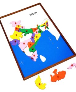
Geography Land Form Cards With Stands: 6 Pairs
1 × ₹3,638.10
 Logical Analysis: Set Of 2 Boards
  Sandpaper Letters Capital
  Grammar Symbols: 2d Shapes
  Imbucare Box With Knitting Ball
  Introduction To Decimal System Beads
  Spindle Boxes
  Control Card - Root Puzzle
  Vowel Boxes Cursive (2 Part Cards)
  Traditional Names
  Moveable Alphabet Cursive Large Wooden
 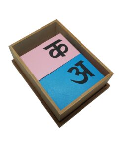 Sandpaper Letters Hindi
  Geometric Tiles
 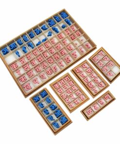 Moveable Alphabet Hindi: 6 Boxes
  Cards Counters
  Seguin Boards Ten (10 To 99)
  Box With Lid For Addition Board
  Evolution Life Story Of A Frog
  Phonograms Cursive
  Dynamic Cubes & Squares
  Object Permanence Box With Tray
  Felt Material: Th, H, T, U
  Botany Cabinet
 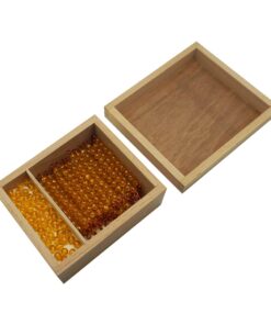 Bead Material For Ten Board
  Geography Land Form Cards With Stands: 6 Pairs
 Subtotal: ₹97,314.29 (Excl.Tax.)